Plan Framework
Mobility
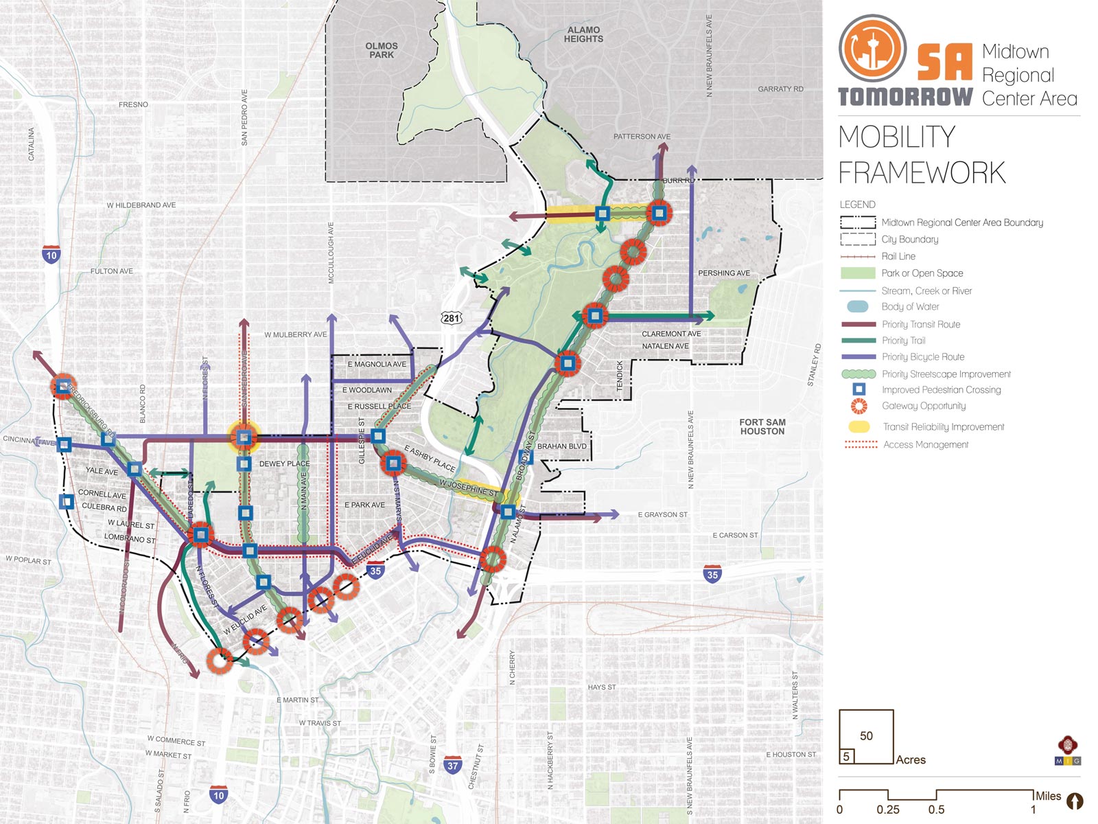
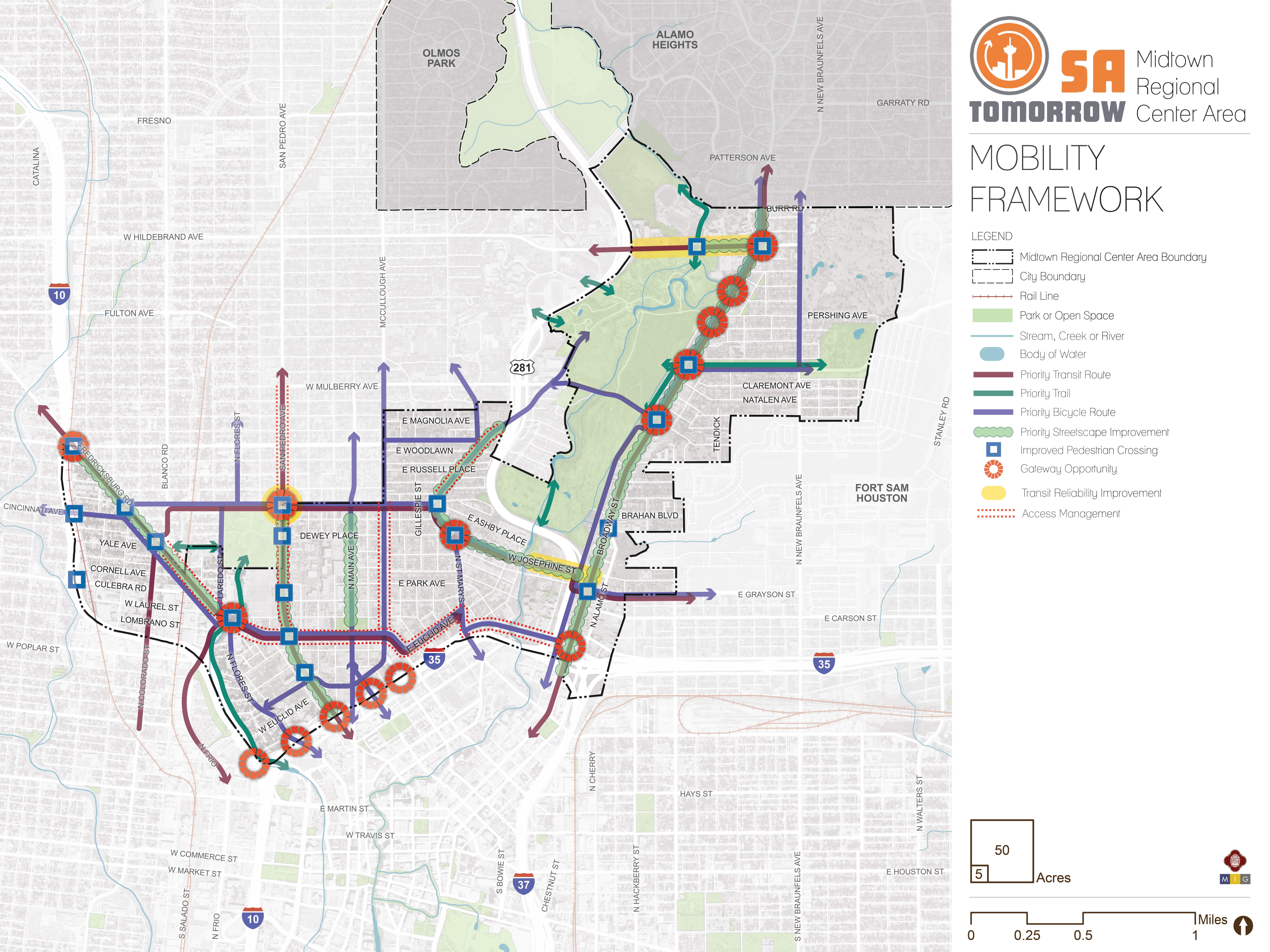
The map below highlights the Mobility Framework identified for the Midtown Regional Center Area. Scroll down to learn more about the vision for Mobility in the Plan Area.
To provide specific feedback on the map, please click and drag a box on that location of the map and fill out the comment box. We would love to hear more from you!
You can also visit the bottom of the page to leave additional feedback.
Background and Transportation Vision
In 2016 the City of San Antonio adopted the SA Tomorrow Multimodal Transportation Plan, to make our city’s transportation system “sustainable, safe, convenient, efficient, and inclusive of all modes.” The plan adopted by City Council established “a shift in focus from moving vehicles to moving people,” in order to manage traffic congestion and improve transportation choices. The plan identified two primary and interdependent methods for managing future traffic congestion:
- Develop a land use pattern and policy to promote local trips
- Provide transportation options in addition to vehicles that connect Regional Centers
SA Tomorrow Multimodal Transportation Plan acknowledged that we cannot build our way out of congestion, and that the Comprehensive Plan, and associated land use plans, are a primary opportunity to improve mobility in San Antonio. By welcoming more people to live, work, and play in urban centers, regional centers, and transit corridors, we can shorten trip lengths, offer more transportation choices, and improve quality of life.
Affordability, diversity, and transportation choices are important elements of the Midtown Vision and Goals. The combined costs of housing and transportation (commonly referred to as H+T) are often a large portion of a household’s budget, with experts recommending the combined total not be more than 45% of household income. In the Greater San Antonio Region that total on average is 53%. Walkable communities that provide great transit options can reduce the household transportation costs for the average person, because if people have an alternative to driving alone, transportation costs can be stable even when gas prices rise. By providing transportation options, as some people choose to go to their destination on foot, bicycle or transit, the number of cars on the road will be minimized, reducing traffic delay for those people that choose to drive.
Multimodal infrastructure investments to transform streets into great public places, such as additional bicycle and pedestrian resources, as well as rapid transit investments from VIA Metropolitan Transit, are needed to better serve existing residents, accommodate new residents and effectively connect the Midtown area to the greater San Antonio region.
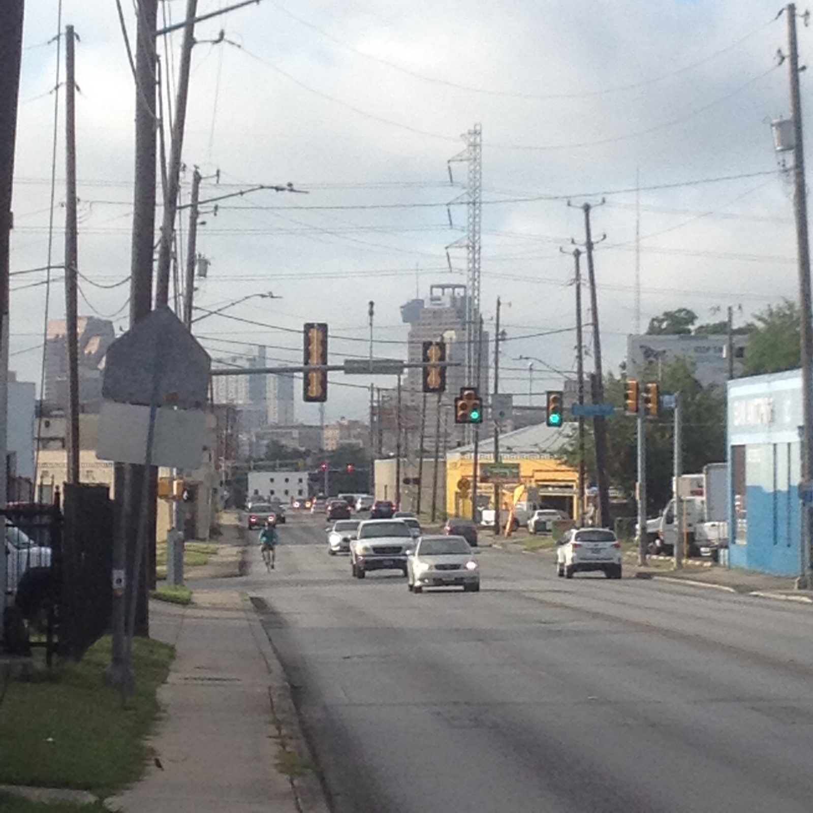
Safety is central to the mobility vision for Midtown. Previous development that focused on prioritizing automobiles leaves many parts of the area with incomplete sidewalks, few bike facilities, and poor access to parks. With a focus on improving safety for people walking and bicycling, Midtown will become a more healthy and connected area, where local residents can access destinations near their homes without having to drive.
VIA Metropolitan Transit’s Primo and Rapid Transit Corridors are expected to provide frequent, reliable service to connect Midtown with the economic activity of Downtown, the South Texas Medical Center, the Airport Regional Center, and other regional housing and employment centers. Improved sidewalks and intersections, along with streetscaping that prioritizes pedestrian safety and comfort will support people using transit to and from the Midtown area. Attention to design priorities like wider, protected sidewalks, street trees, and seating and shade amenties will improve last mile connections between transit stations and destinations.
Midtown’s Mobility Needs:
Midtown has long been a critical gateway to the city center, is home to thousands of people, and has many destinations. Key transportation needs identified for this Midtown include the following:
- Safety on the transportation network for all modes, but especially pedestrian and bicyclist safety;
- Multimodal improvements - transformation of the transportation network to serve people choosing to walk, bicycle, scooter, take transit, rideshare, or travel in their own vehicle;
- Ensure that the mobility network supports, responds to, and directly implements the future land use plan; and Congestion reduction in key hotspots.
To address the mobility needs in the Midtown study area, a set of high level recommendations has been developed with input from the Midtown Area Regional Center Planning Team and community stakeholders, and a set of strategies have been identified to implement the recommendations through projects, policies and partnerships.
Recommendation #1:
Continue implementing the San Antonio Vision Zero Action Plan.The City of San Antonio’s Vision Zero initiative aims to achieve zero fatalities on the community’s roadways and improve roadway safety for all users, whether driving, bicycling, or walking. The Vision Zero initiative evaluates and makes recommendations to improve safety in Severe Pedestrian Injury Areas (SPIAs), locations where two or more crashes close together have resulted in severe pedestrian injuries.
Potential tools for improving pedestrian safety in Severe Pedestrian Injury Areas include Leading Pedestrian Intervals, Medians, and Pedestrian Crossing Islands based upon analysis of the unique factors that contribute to crashes in each location, and depending upon the results of engineering assessments. Another approach to improving safety involves dedicating more space in the roadway to bicyclists and pedestrians. From new ways to protect bicycle lanes with separated barriers such as bollards, to landscaping and planters and raised medians, San Antonio has many available tools to improve pedestrian and bicycle safety. The City of San Antonio Vision Zero Action Plan lists additional tools for improving pedestrian and bicycle safety.
The 2018 San Antonio Severe Pedestrian Injury Areas Report (pages 26-29) identifies Severe Pedestrian Injury Areas (SPIAs) in the Midtown Area Regional Center that should be priorities for study and investment:
- Broadway Street from Josephine Street to Army Boulevard and between Eleanor and Natalen Streets;
- McCullough Avenue from Cypress Street to Dewey Place;
- Cypress Street from Maverick Street to Main Avenue;
- San Pedro Avenue from Laurel Street to Euclid Street;
- Fredericksburg Road from Sandoval Street to Laurel Street.
Beyond Vision Zero’s Severe Pedestrian Injury Areas, pedestrian crossings should be improved where planned employment growth, population growth, and transit and amenity improvements will lead to an increase in the number of pedestrians using the street. The Mobility Concepts map includes locations for TCI to consider studying improvements, based on input from the Midtown Planning Team and community residents and stakeholders. Additional locations identified by residents are highlighted in the respective Neighborhood Profiles and Priorities for each neighborhood.
Access ManagementFor all people to travel safely while walking, bicycling, or driving in the study area, points of conflict such as driveways and non-perpendicular intersections should be minimized. The 2017 Capital Improvements Bond program will address these issues in some locations. Curb cuts and associated conflicts on multimodal streets cannot be corrected through public street projects alone, but rather should also be addressed through the City’s Unified Development Code that regulates, among other things, where driveways are constructed when new development occurs. TCI should be supported in creating strategies and unified development code updates to reduce these points of conflict.
Recommendation #2:
Complete the multimodal network by investing in critical corridors, leveraging existing assets, and establishing partnerships to implement critical connections.The Midtown planning team and community residents and stakeholders indicated that complete sidewalk and trail networks should safely connect regional destinations, neighborhoods, transit, employment, shopping, schools, and green spaces, and that biking should be safe and enjoyable for people of all biking comfort levels. San Pedro Avenue, McCullough Avenue, Main Avenue, and Cypress Street are recommended for the Transportation and Capital Improvements Department to study for complete streets improvements, coordinating with TxDOT, VIA, and ongoing Bond projects as needed.
Complete streets envisioned for the Midtown Area, providing safe road designs for vehicles, pedestrians and cyclists alike, should be evaluated by TCI in several locations. The SA Tomorrow Multimodal Transportation Plan includes recommendations for making San Pedro Avenue a more complete street.
Priority Streetscape ImprovementsStreetscape improvements such as trees, decorative street lighting, benches, or other place identifiers can enhance the unique qualities of a place and make walking and exploring more enjoyable.Such improvements are envisioned on the following roadways that are not part of the 2017 Capital Improvements Bond:
- San Pedro Avenue from Ashby Place to IH 35;
- Main Avenue from Cypress Street to Ashby Place;
- Josephine Street from St. Mary’s Street to Broadway Street.
- Hildebrand Avenue from the San Antonio River to Broadway Street.
The dense street network throughout much of Midtown provides numerous route options to key trails like the Martinez Creek Greenway, San Antonio Riverwalk Museum Reach, and the San Pedro Creek Cultural Park. These trails connect with long and uninterrupted separated pedestrian and bicycling infrastructure that connects important local and regional destinations. The Mobility Concepts map indicates key points for improving trail, water, and park access to ensure these community assets are accessible to people who want to discover and use them. Several of these recommendations are discussed in the Amenities and Infrastructure section of the Midtown Area Regional Center Plan. They primarily relate to the San Antonio River, Catalpa Pershing Channel, Brackenridge Park, San Pedro Springs Creek and San Pedro Springs Park, and connecting Uptown St. Ann’s neighborhood and westside neighborhoods with Midtown’s parks and trails.
Preferred Bicycle RoutesInput from the Midtown Planning Team and community residents and stakeholders strongly supported improving Midtown’s bicycle infrastructure. The Transportation and Capital Improvements Department (TCI) studies and implements bicycle facility projects, such as bicycle lanes, throughout San Antonio. In many places, bicycle facilities already exist and are either adequate or might be improved. In other cases, the location for study may represent an important connection between destinations or portions of the bicycle network, such as connecting the San Antonio River, with San Pedro Springs Park, Martinez Creek Greenway Trail, and Woodlawn Lake. Additional opportunities for improving bicycle facilities should be explored as street striping, resurfacing, and reconstruction projects are scoped and designed.
Recommendation #3:
Manage transportation demand by creating walkable places and supporting efficient transit operations through targeted interventions.While traffic congestion can be viewed as a sign of economic activity, delays caused by congestion waste valuable time and create transportation emissions that reduce air quality. Congestion also reduces the effectiveness of VIA’s transit routes, although key investments to reduce congestion can help VIA services stay on schedule. These improvements, paired with other VIA investments in service, can help make transit a more attractive travel option and further reduce congestion on our roadways.
Key improvements that could improve transit mobility include peak hour bus-only lanes that give priority to buses in times of heavy traffic; queue jump traffic signals that allow buses a chance to get ahead of the traffic; special event priority lanes that give priority to buses in times of heavy traffic; and bus bulbs to allow buses to pick up passengers without exiting and re-entering traffic. Studies will need to be conducted to determine the appropriateness of each strategy for the areas of local congestion.
Recommendation #4:
Support VIA Metropolitan Transit Rapid Transit Corridor service by prioritizing transit supportive policies and infrastructure near transit stations.Every person that rides transit is also a pedestrian. As VIA Metropolitan Transit improves transit options in Midtown and throughout San Antonio, these services should be easily accessed by people walking and bicycling to transit stations and stops. Investing in complete streets along transit corridors as well as streets that lead to stations will not only improve the transit riders’ experience, but also improve the experience of walking and riding a bicycle for everyone.
This recommendation supports the community's goal to Promote Great Transit, shared by the City and VIA Metropolitan Transit’s objectives to improve access to key destinations, decrease vehicle miles traveled, and increase walkability. More information on the City’s approach to implementing transit supportive policies and infrastructure near transit stations is available in the SA Corridors Framework Plan.
There are currently over twenty VIA Metropolitan Transit service routes that serve Midtown residents and employees, and others riding through the area. Future VIA Metropolitan Transit Rapid Transit Corridors or Primo routes are being evaluated by VIA related to the following roadways:
- Colorado/Fredericksburg Road
- San Pedro Avenue
- Broadway Street
- Cypress/ Euclid / Grayson Street
Mobility Concepts
The recommendations in this plan will help create a user-friendly multi-modal transportation network that provides access to amenities and that links Midtown Area residents and employees to the greater San Antonio Area. The general concepts below serve as guiding principles for the more detailed Mobility Recommendations listed above, and several are illustrated for the Midtown Area on the Mobility Concepts Map.
Complete Streets
In September 2011, San Antonio adopted a Complete Streets Policy (Ordinance 2011-09-29-0795) which encourages street designs that take into account all users and accommodate all ages and abilities including children, older adults, and persons with disabilities. This approach to street design “supports pedestrian and bicycle-oriented neighborhoods; promotes healthy living, fitness, and activity; enhances the economic vitality of commercial corridors and districts; and maximizes the benefits of investment in public infrastructure.” Not all “complete” streets have to be the same; the function of the road, level of traffic by mode, and adjacent land use and intensity will all be used to help determine road type and design features.
Resources that readers may use to visualize or understand the variety of tools available for improving pedestrian and bicycle safety and comfort may consider the following:
Priority Bicycle Routes and Streetscape Improvements
Communities that encourage walking and biking as convenient, safe, and comfortable options have an integrated network of comfortable pedestrian and bicycle routes along with well designed streets in key activity areas.
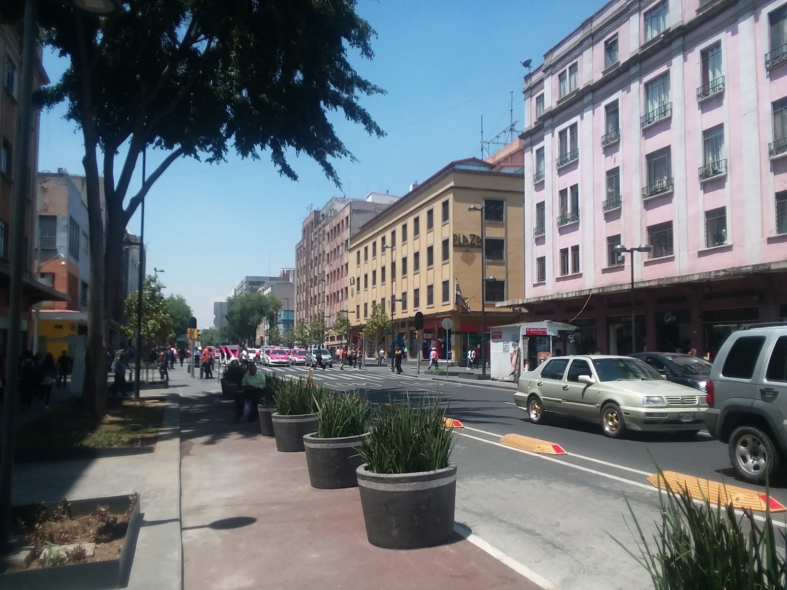
Looking beyond the 2017 Capital Improvements Bond Projects, the City should consider additional streetscape improvements in corridors where this plan anticipates many people will living, working, and playing in surrounding areas, and where there are opportunities to connect important and iconic places. These include the focus areas and mixed-use corridors identified in the Plan Framework Map.
Improved Pedestrian Crossings
Safety is central to planning for the Midtown Area’s development as a collection of walkable places. Analysis of previous pedestrian crashes has identified intersections and roads most in-need of study for additional pedestrian crossings or other safety improvements. Improved access to VIA service is also a key factor guiding pedestrian safety studies and investments.
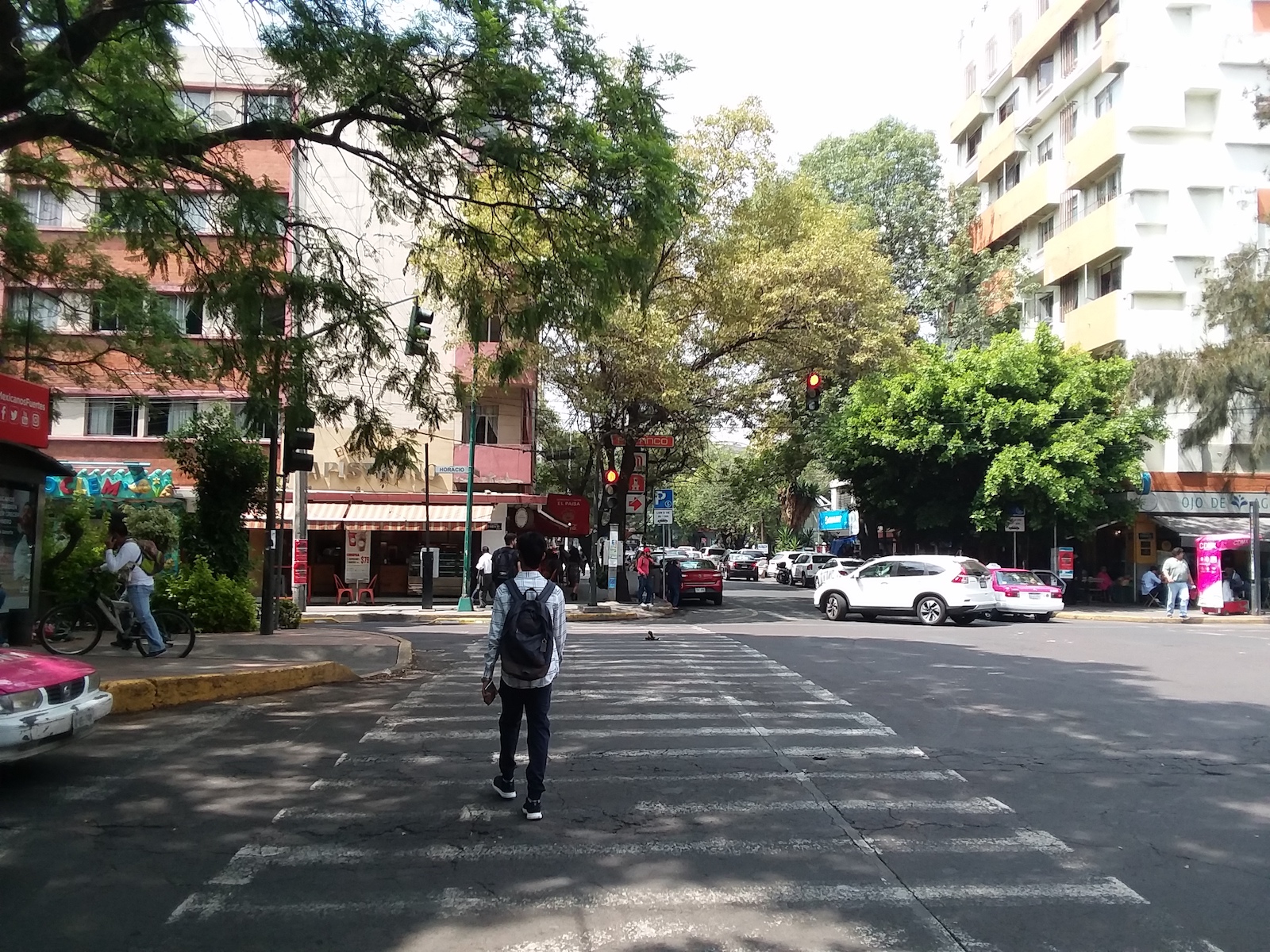
Frequent, Reliable, and Accessible Transit
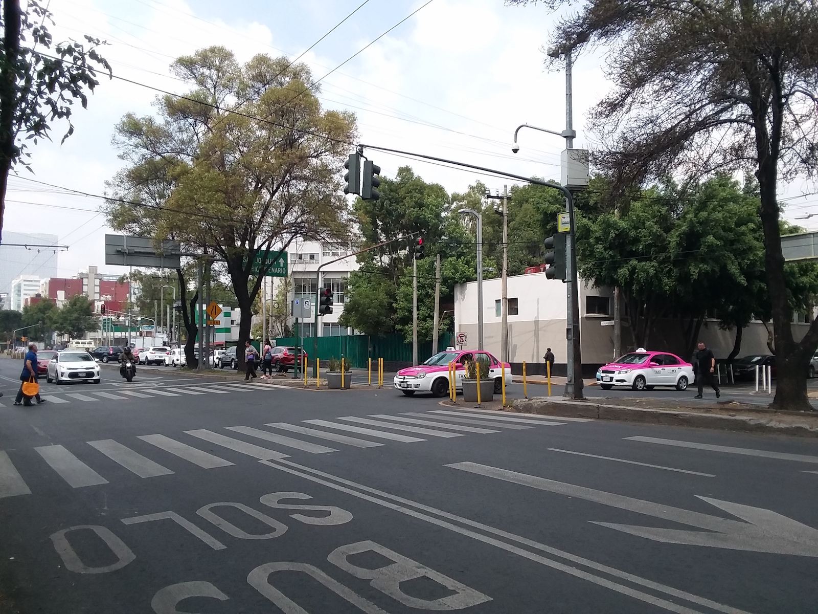
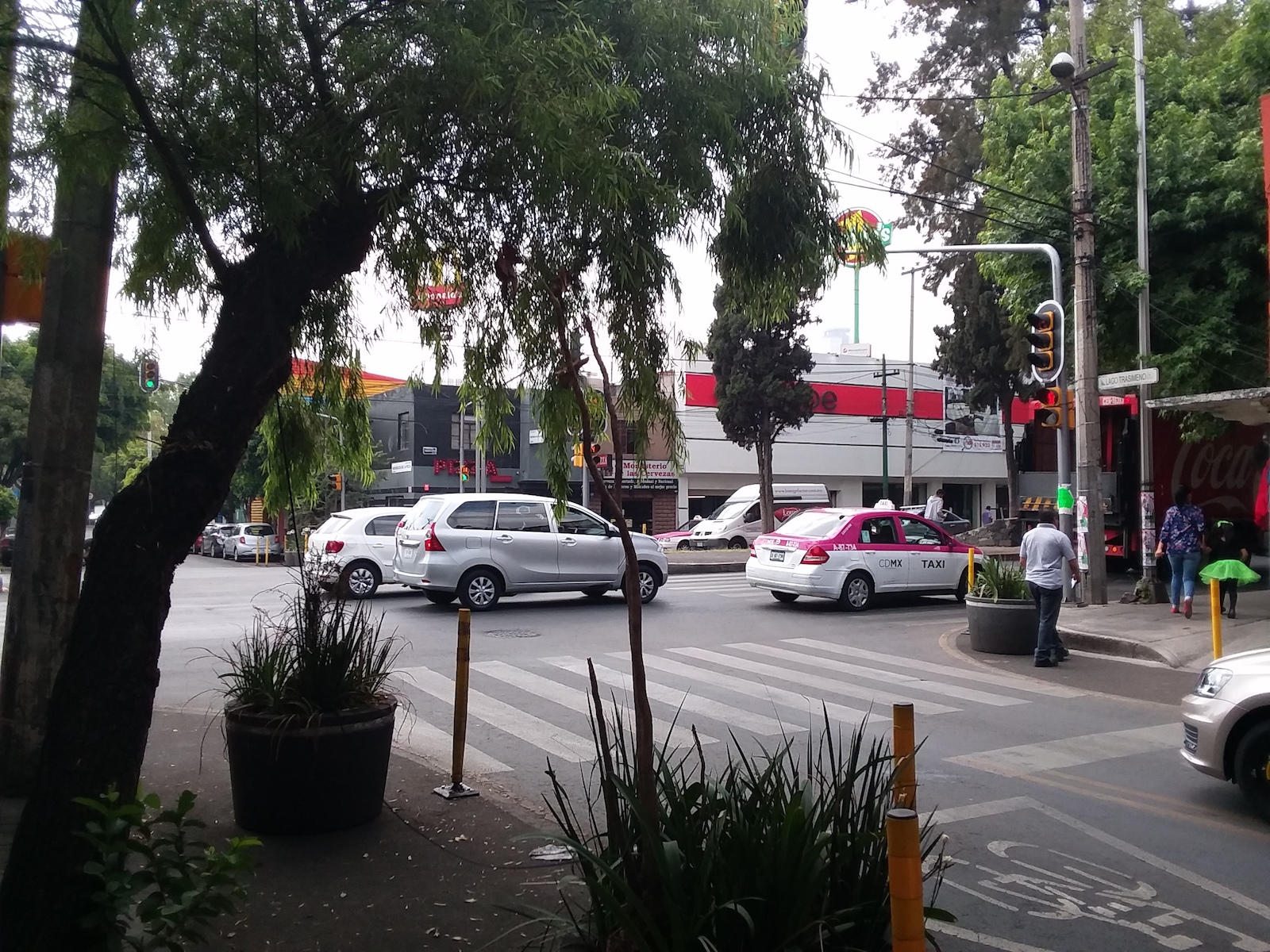
Crosswalks, a crossing median, and street trees improve comfort and safety for pedestrians accessing transit service in Mexico City.
VIA’s ongoing planning efforts are working to identify new Primo and Rapid Transit corridors. Detailed studies are looking at exact routing and phasing of construction for these improved transit routes that will provide more options for people to get around both within the Midtown Area as well as to other employment, education, and activity centers across the city. Complete streets and place making investments near planned stations are important to improve people’s ability to access transit using safe and pleasant community connections.
Linked Mobility and Land Use
As communities evolve and grow, so do the demands on the mobility system. The location and type of growth in an area or along a corridor help determine the demand on the transportation network and viability of various transportation options. Likewise, transportation helps shapes the desirability and type of development in an area. Aligning this relationship shapes future development and growth patterns and directly supports the community’s goals and objectives of improving walkability, increasing access to transit, and enhancing access to economic areas and other key destinations. Such alignment of land use and mobility also helps implement VIA’s 2040 Strategic Plan for Station Areas, supporting transit-supportive land use surrounding transit stations.
As the Midtown Area Regional Center adds residents and employees based on the community’s updated land use plan and proposed focus areas and mixed-use corridors, impacts on the mobility needs of these new people and those of the current residents need to be considered. For example, as more people choose live, work and play in the area between San Pedro Avenue and Main Avenue, additional pedestrian, bicycle, and vehicle traffic can be expected on the streets and new mobility patterns will emerge. Studies will need to determine common paths and volumes of pedestrian, bicycle, automobile, transit, and freight travel to ensure the area has sufficient infrastructure and careful prioritization of modes to help people safely reach their destinations.
Mixed-use and higher density developments in identified focus areas and along key corridors will require integrated mobility planning to ensure people can access, use, and pass through these areas safely and comfortably by all modes of travel. With additional density in land use, the major roadways can anticipate additional pedestrians, bicyclists, transit riders, single automobile vehicles and freight delivery trucks of various sizes. In the future, more density in the area will mean more demand for pedestrian and bicycle facilities and VIA transit service.
Gateway Opportunities
To build highlight the identity of places in Midtown. gateway improvements such as lighting, art and architectural elements which reflect neighborhood history and culture should be considered at locations that serve as the beginning of or entrance into a uniquely definable place. Some potential Gateway Opportunities are included in the Mobility Concepts Map, however other opportunities exist throughout the plan area. For example, Westfort Alliance Alliance residents indicated some interest in identifying their neighborhood with signage, for visitors passing on Broadway or entering onto Army Boulevard.